Scafell Pike
“...roughness and ruggedness are the necessary attributes [to make a mountain]...and [Scafell] Pike has these in greater measure than any other high ground in the country—which is just as it should be, for there is no higher ground than this.”

One mile to Seathwaite and the trailhead.
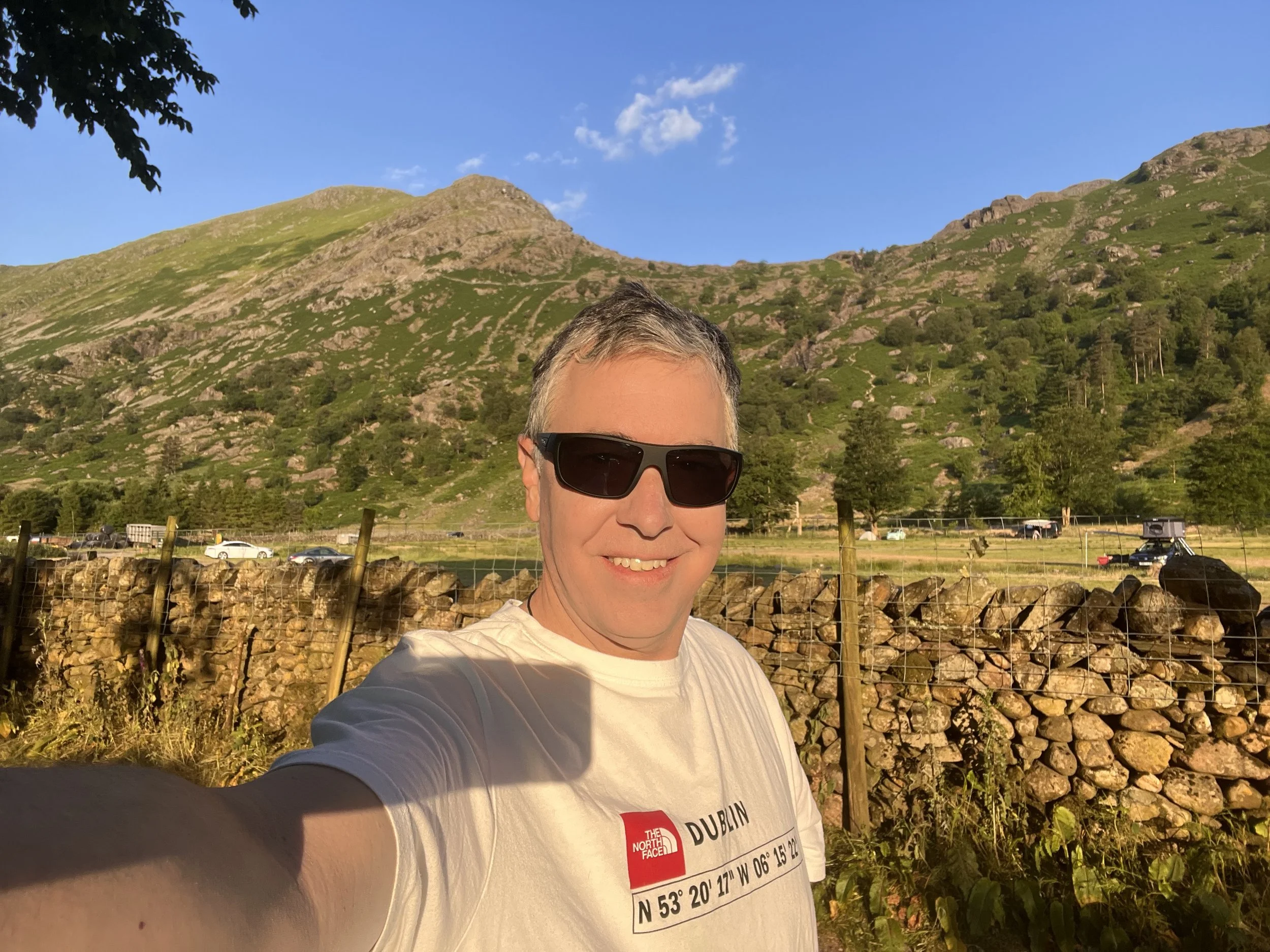
Car parked and ready to hit the trail at 6:20 am.

And so it begins. The prominent peak in the distance is Seathwaite Fell. My route will follow the River Derwent to its headwater directly up the gill (ravine) left of Seathwaite Fell, ending at the obvious saddle in the far distance.
My return route will come from the right of Seathwaite Fell, down through the copse of trees.
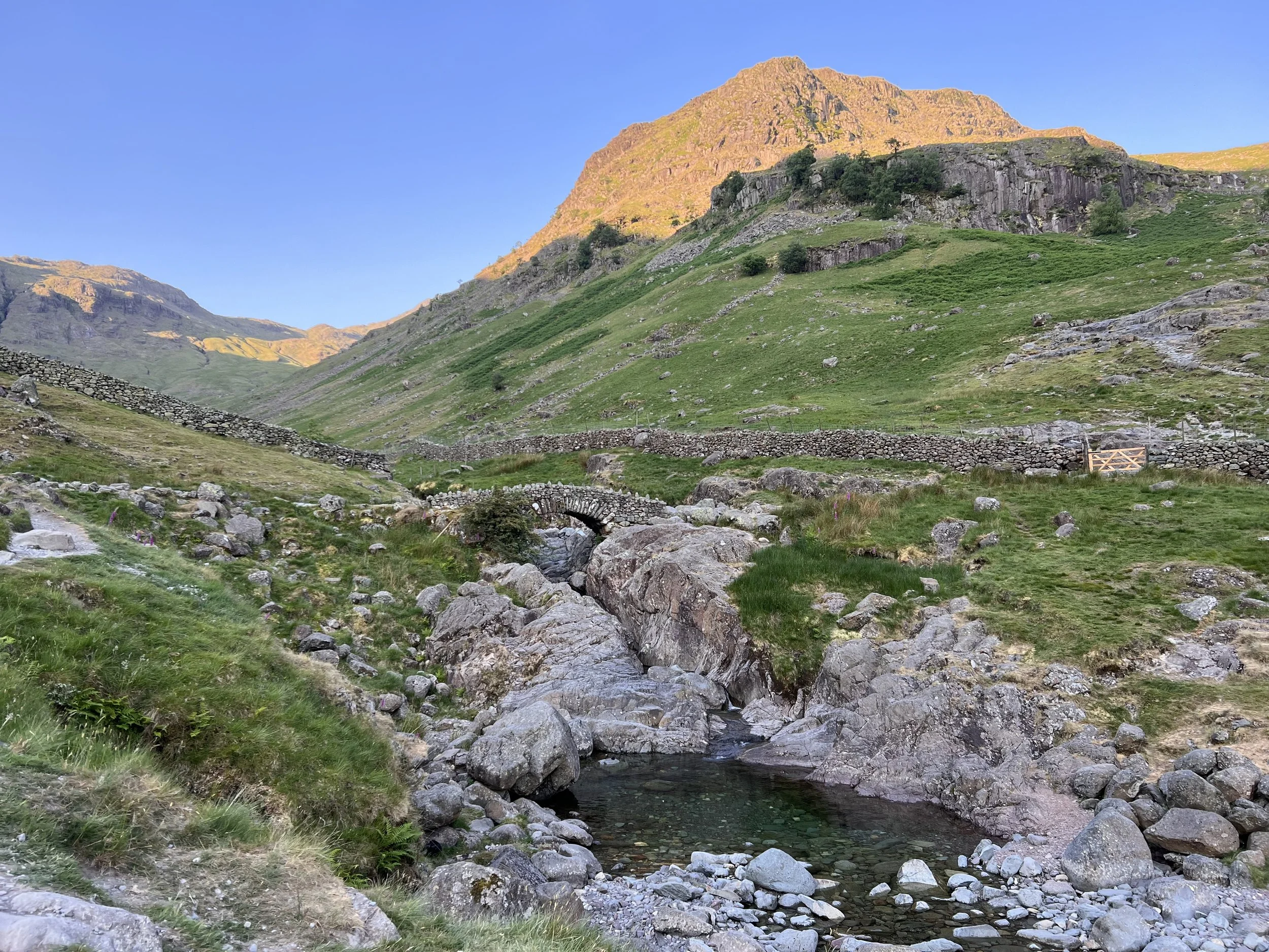
An idyllic scene with the pretty pool of water formed by the relatively low river levels. The stone bridge over the River Derwent leads to the gate on the right.
Through the gate I turn left and follow the path up the gill to the left of Seathwaite Fell—known as The Scafell Pike Walk Route.
My trail home is just visible up and right of the gate.

Perhaps halfway toward the saddle and Seathwaite Fell seems to slide to the right, allowing the imposing north face of Great End to finally come into view in the distance.
“This is the true Lakeland of the fellwalker, the sort of terrain that calls him back time after time, the sort of memory that haunts his long winter exile. It is not the pretty places—the flowery lanes of Grasmere or Derwentwater’s wooded bays—that keep him restless in his bed; it is the magnificent ones. Places like Great End...”

A black slug (Arion ater)

Finally reaching the saddle I had strived toward for so long, I could see to my right Sprinkling Tarn resting below the base of Great End.
I continued left and climbed another pass over, the east shoulder of Great End, to reach this plateau known as Esk Hause, where someone found a spectacular spot to make camp!

The trail continued west behind Great End, and the summit first becomes visible in the far distance. While the majority of the climb was done, the trail still held a few tricks in waiting.

The faster pace on the more gentle slope of the plateau behind Great End was short-lived. A scramble up and over a rocky peak revealed a significant descent across a large scree field.
After the slow-going over and down the scree field, all that was left was the final steep climb up the northeast side of Scafell Pike.
The above photo is taken from halfway up Scafell Pike, looking back on the huge scree field and down the massively eroded “trail” up the peak.

Standing near the summit cairn looking west, with Wast Water just behind my ear and the North Sea beyond. The air over the Sea is hazy, but if it was clearer you would see Isle of Man further west.
The visible trail is the one I will take down, and the most popular route to the summit.

The view from on top the monument looking east back over the trail from where I came.
The fourth mountain from the monument is Great End.
After climbing up the third mountain top and crossing the obvious trail, a scramble is required to reach the top of the second mountain top.
What awaits after that can only be described as a non-stop exercise in rock hopping to cross the huge scree field.
A large descent and climb is deceptively hidden between the second peak and the monument.
In the following video, look for the small lake (tarn) when I say, “I came up roughly from down in that valley way down there.” See how far away it is! I have a picture of the tarn toward the bottom of the post. Here’s the video: https://www.youtube.com/watch?v=sms1TMToEOA
Three Peaks Challenge
The National Three Peaks Challenge is an event in which participants attempt to climb the highest mountains of England, Scotland, and Wales within 24 hours. It is frequently used to raise money for charitable organizations. Walkers climb each peak in turn, and are driven from the foot of one mountain to the next. I plan to complete the challenge, only not in 24 hours.
Of the Three Peaks, many argue that, despite being the lowest in elevation, Scafell Pike is the hardest due to the overall difficulty of the paths to the summit. The Three Peaks are:
Ben Nevis—4,413 ft
Yr Wyddfa/Snowdon—3,560 ft
Scafell—3,209 ft
Remember my Yorkshire in Repose post, when I mentioned the semantics the Brits play with being the oldest this and that? Well, the same game goes for mountain peaks.
Scafell Pike claims to be the highest peak in England, because the name England excludes Scotland and Wales.
Overall, Yr Wyddfa/Snowdon is the second highest peak, but Wales is considered part of Britain and the United Kingdom (UK), but not part of England. Since Ben Nevis by definition has both the UK and Britain titles in wraps, and Wales is not considered part of England, the best claim the peak can settle for is the reduced title of tallest peak in Wales.
Ben Nevis is the tallest peak in the United Kingdom (a title that includes England, Scotland, Wales, and Northern Ireland), which means is it the tallest peak in the UK, Scotland, and Britain. But technically, it is not the tallest peak in England.
BTW, the title Great Britain means nearly the same thing at the UK (i.e.: England, Scotland, and Wales); however, it excludes Ireland.
Clear as mud?! 🤯 🤯 🤯
War Memorial
Scafell Pike was one of 13 Lakeland summits given to the National Trust in the years immediately after the first world war, in what was known as the “Great Gift.”
The mountain was given to the trust by Lord Leconfield when the war ended, in memory of the thousands of men from the Lake District who had fought and died. A large memorial was created on the summit in their honor.

I failed to take a photo of the monument, so here is one from someone else so you see what it looks like.
In 2018, National Trust rangers rebuilt England’s highest war memorial to mark 100 years since the end of the first world war. The 24-foot diameter memorial stands about six feet tall.
The words inscribed on the memorial read: “In perpetual memory of the men of the Lake District who fell for God and King for freedom, peace and right in the Great War 1914-18.

Despite the relatively low elevation, I consider it a great accomplishment given the difficulty of the trail. It was a wild ride reaching the top. Even Alfred Wainwright described Scafell Pike as “…every inch a mountain.”
Little did I know the hike down would also be very challenging.
And God bless the people at The Cornish Bakery for making the perfect food not just for miners but also for hikers. A breakfast pasty and an apple, and I’m ready to head down.
Mach Loop
There are three Tactical Training Areas (TTA) used for operational low flying training flights in the UK.
The most famous is the Mach Loop in Central Wales. We had wanted to visit while we were in staying in northern Wales, but there were no operations taking place during our stay.
What we did not realize was that the Lake District National Park lies in the middle of the Borders TTA. We have been watching jets scream across the sky at very low altitudes for the past two weeks, but have never been able to capture any on film.
As I was just beginning to descend Scafell Pike, I was able to capture these two—turn your volume up and hear the power baby! https://www.youtube.com/watch?v=HgnCucJhVc4

After taking the initial path that overlaps with the most popular route from Wasdale Head, I turned east to take the Corridor Route back to my trailhead in Seathwaite.

After the trail disappears around the corner in the distance it reached a section where the hillside was fairly sheer. Over time the trail has eroded and much of it has fallen down the ravine. The trail became so thin that I had to stash my trekking poles and, for a few hundred feet, scramble across the cliffside in what I would say qualified as low level Class 5 climbing. It was much easier to navigate from the direction I came because the trail slowly disappeared and I climbed up and back onto the normal trail. I hate to imagine people coming from the other direction where the trail suddenly disappears over the cliff and you have to find your way across. I ran into a couple who were at that point. She seemed petrified. I gave my best advice and continued on. I made it safely across and was not about to do it again!

Styhead Tarn (remember this was visible from the summit).

Read about the following map below.

This is the portable Ordnance Survey (OS) map on my phone. The route starts at the top and flows clockwise. The maroon is the path as I planned it on the app, and the dark blue is the actual path I walked.
I hate the scale of the OS maps because they’re too small to be truly useful, but their philosophy is people walk really long distances and don’t want to carry that many maps. Hey, for the price of £9 I got both the paper map and the electronic version, which followed my progress real-time. So, super helpful!
Did you know that the UK’s ubiquitous Ordnance Survey (OS) maps have their origins in the final Jacobite uprisings? After the English slaughtered the Scottish Battle of Culloden, they began a program of building roads and fortifications in Northern England and Scotland. The map-making work of that program became the modern OS maps.
Up - 4.91 miles in 2 hrs 48 mins
Down - 4.98 in 2 hrs 48 mins
No kidding! How’s that for nearly exact numbers?! For as far back as my memory serves me, this is the first time my descent time was not roughly half of the climb time. Goes to show how difficult the descent was.