Outer Hebrides
“To hear the stones speak requires inner silence and a reverence for the sacred place in which you stand. Remember this when you stand before them.”
The archipelago off the western coast of Scotland is known as the Hebrides.
They are often divided into two main groups—the Inner and Outer Hebrides. (The Outer Hebrides are also known as the Western Isles.)

This map of the ferry routes groups the islands nicely. The Inner Hebrides lie closer to mainland Scotland and include Islay & Jura (pink); Mull, Iona, & Staffa (aqua); Skye & Raasay (green), and the Small Isles. There are 36 inhabited islands in this group.
The Outer Hebrides (orange) form a chain of more than 100 islands and small skerries (rocky island) located about 45 miles west of mainland Scotland.
Of the Outer Hebridean islands, 15 are inhabited. The main inhabited islands include Lewis and Harris, North Uist, Benbecula, South Uist, and Barra.
The Inner and Outer Hebrides are separated from one another by the Minch to the north and the Sea of the Hebrides to the south.
The Minch is a strait in northwest Scotland which separates the mainland from Lewis and Harris in the Outer Hebrides. The Minch's southern extension, which separates Skye from the middle islands of the Hebridean chain, is known as the Little Minch.

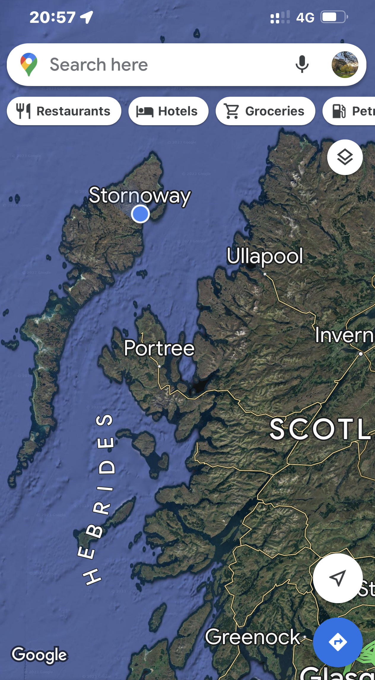
Here’s the map again so you can see the Uig Ferry Terminal on Skye (green) and the route we took to reach the Tarbert Ferry Terminal on the Isle of Harris (orange).
Since you're already looking at the map, we are staying in Stornoway on the Isle of Lewis (orange). When we leave the island on Wednesday, it will be on the ferry from Stornoway to Ullapool back on the mainland.

Our ferry to the Outer Hebrides.

Departing Uig. So long and ta Skye!

The view across the Little Minch.

Getting close to Tarbert, the mini Tarbert Lighthouse.

A beautiful sailboat adds to the scene. The Scalpay Bridge in the distance and salmon farms in the middle ground.
Nisabost Beach
After arriving on the ferry, we drove south to visit a few sites on the Isle of Harris before driving to our cottage, which was well north in the city of Stornoway on the Isle of Lewis.

Our first stop was at Nisabost Beach.


With stunning beaches and beautiful clear turquoise water, if you ignore the water temperature, you could pretend you were in the Caribbean!
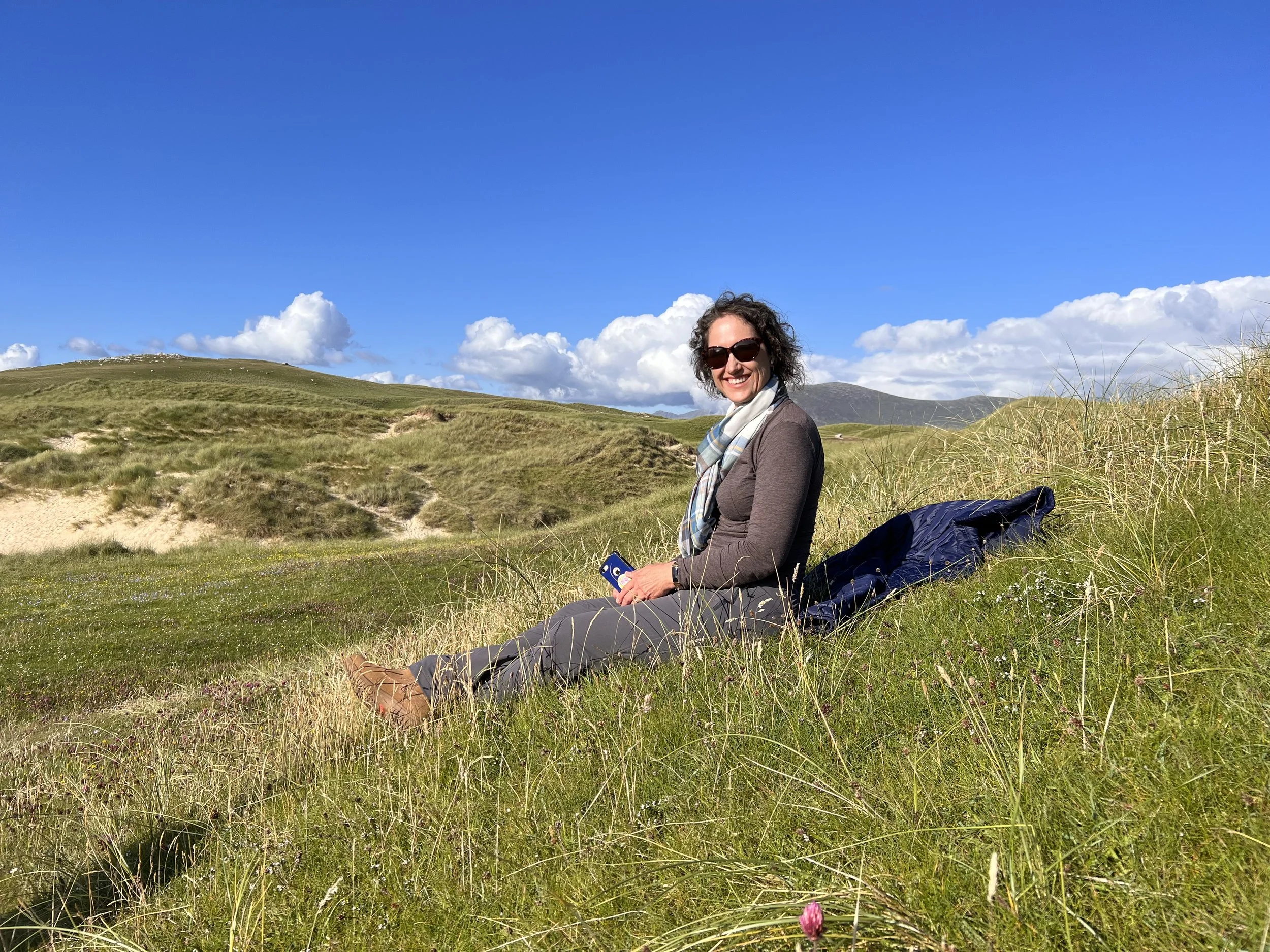
Christa on the machair (a Gaelic word meaning fertile, low-lying grassy plain).
Machair habitat is very similar to a fixed sand dune but is easily distinguished by its flat or gently undulating landscape.
It is one of the rarest habitats in Europe and only occurs on the exposed west-facing shores of Scotland and Ireland.

Manchair vegetation.

MacLeod's Stone on the bluff overlooking Nisabost Beach.

So, so many standing stones litter the UK.
St Clement’s Church

Isolated at the very southern tip of the Isle of Harris is the small hamlet of Rodel, which is home to the medieval St Clement’s Church.

Call the Midwife visited St Clement's Church for their Season 9 (2019) Christmas Special.

The cast is seen walking up this path.

Fàilte (welcome)

Nice shot Dave!


The church was founded by Alasdair “Crotach” MacLeod of Dunvegan and Harris, 8th chief of Clan MacLeod. He died in 1547, and his remarkable tomb can still be seen in this recess.

The Golden Road
If you zoom in on the map below, to the tiny village of Rodel at the southern end of the Isle of Harris, you will see the small roadway that makes its was north along the eastern shore of the island.
This road is known as the Golden Road. It’s widely assumed it got its name because of the construction cost—if it cost that much then it must be made of gold!—but like much island folklore, that is disputed.
Local historian Bill Lawson says the name officially relates to the first sealed road in Harris, built in the years after World War II, as a safety measure after many accidents when people waded across rivers to get home.

While a paved road, traffic tends to be minimal on this winding single-track route.
From Rodel, the road twists and turns for 21 miles before making its way back to A859.

Unlike the sandy and grassy Caribbean feel of the western side, Harris’s rocky east coast looks more like a lunar landscape, filled with rocks.

The scenery made the wild drive worth the effort.

Stornoway
Stornoway is the main town of the Western Isles and the capital of Lewis and Harris.
Stornoway is the main port on the island. The sheltered harbor is the reason for the town’s existence and was named by the Vikings "Steering Bay" which, when phonetically translated, became the name Stornoway.
Lewis and Harris is a single Scottish island divided by mountains. The northern two-thirds is called Lewis and the southern third Harris—each referred to as if it were a separate island, largely because there are many cultural and linguistic differences between the two.
The blue dot above is us at dinner at Eleven, a restaurant inside the Caladh Inn in Stornoway. Pretty wild seeing just how far out in the middle of nowhere we are.
The owner of the Vrbo we stayed in connected me days before our arrival to say he had double-booked his place, so he arranged for us to stay in the house adjacent to his. As it turned out, we think the house we ended up in was much nicer than the original. Bonus!
Here is a video tour of our place in Stornoway: https://www.youtube.com/watch?v=cCMtcJADRqc
The Calanais Stones
Monday (Jul 31) was our first full day on Lewis and we started off by driving to the island’s most famous landmark—the Calanais Stones.

Over 900 stone circles were built in Britain between approximately 3,400 BC-1,350 BC.
Construction of the Calanais circle began sometime between 2,900-2,600 BC.
Stonehenge was estimated to have been built between 3,000-1,520 BC.
So, although roughly 500 miles apart, construction of the UK’s two greatest stone circles began at roughly the same time.

Calanais is one of the UK’s most complete stone circles.
Surrounded by sea lochs and cold, peat moorland hills, the circle consists of thirteen distinctly shaped stones each standing from 8 to 12 feet high.

Inside the circle is the center stone towering nearly 16 feet in height.


Leading off from the circle are five lines of stones.

Two of the lines form a long corridor heading slightly east of True North. Seen from above the design of Calanais forms a large cross with the circle at its center.

I don’t hear any buzzing…I think it’s safe to touch the stone…

Phew! 😅
In the YouTube video below, Amanda traces the steps of Sister Monica Joan from Call the Midwife when she visited the Calanais Stones .
I could only find a video clip on Twitter, so you can view the clip by following this link:
https://twitter.com/CallTheMidwife1/status/1209931604656873472?s=20

Who are these larger-than-life figures? The Superheroes of Calanais?

Oh, it’s just you two…
Dun Carloway Broch
Brochs are among Scotland's most impressive prehistoric buildings. These stone roundhouses date from about 2,300 to 1,900 years ago, and are found mainly in north and west Scotland.

Dun Carloway was probably built in around 200 BC and may have been occupied by a local chief, as a symbol of status and control over the local landscape and resources.

At 30 feet tall it still stands close to its impressive full height.

Dun Carloway shows an excellent cross-section of a broch.

An artist’s interpretation of how brochs were likely designed inside.


Dave and Christa take in Loch an Duin and the sea loch beyond.
The Blackhouse, Arnol

The blackhouse village in Arnol boasts a number of traditional Lewis thatched houses, one of which is fully furnished with an attached barn, byre (cow shed), and stackyard (straw and/or grain house).

Built in around 1880, these houses give a special insight into island life.

The blackhouse with the restored interior was once the residence of a Hebridean crafting family and their animals, who moved out in 1966. Today it is preserved almost as the family left it. Mmm, love that peat fire.

A stack of peat waiting to fill the air with its wonderful smoky aroma.

The Isle of Lewis and Harris is known the world over for Harris Tweed, so it was only fitting that the house had a working treadle-pedal wool loom in operation.

Along with St Clement's Church and the Calanais Stone Circle, the blockhouse village also featured in the Season 9 Christmas special of Call the Midwife.
I couldn’t locate the video any other way, but if you click on the link below (or copy and paste it), it will take you to a short clip on Facebook about the filming the Call the Midwife Christmas special. It really is a great short video and shows all three locations:

The term blackhouse—taigh dubh in Gaelic—appeared in the mid-19th century, to distinguish the soot-filled fieldstone houses from the white, modern taigh geal (white house) that became popular on the Outer Hebrides in the 1850s.

A typical “white house” (with a grey addition) that can found all across the Isle of Lewis.

Butt of Lewis Lighthouse
After visiting the blackhouse village, we continued north to the Butt of Lewis—the most northerly point of Lewis and the Outer Hebrides.
The headland, which lies in the North Atlantic, is frequently battered by heavy swells and storms and is marked by the Butt of Lewis Lighthouse.

The station's claim to fame was getting into the Guinness Book of Records as the windiest spot in the United Kingdom.
Take a look at the picture and see what you think.

The lighthouse was designed and built by the famous lighthouse builder David Stevenson, author Robert Louis Stevenson’s uncle.

Crazy rock formations on the right.

Port Stoth, a sheltered inlet just southeast of the Butt of Lewis.
Port of Ness
You would think that after seeing the Butt, we had reached the backside of our day, the bottom if you will.

However, there was just one more quick stop in Port of Ness, because I was in the middle of the novel—the first of The Lewis Trilogy—The Blackhouse, by the popular Scottish television screenwriter, novelist, and crime writer Peter May.

At the outset of the novel, a murder victim is found inside the boat house (the white building at the end of the harbor wall). Seeing the place in person makes the book so much more engaging!
Happy 29th Anniversary!

That evening, Dave and Christa enjoyed a wonderful anniversary dinner at the Boatshed Restaurant in Stornoway.